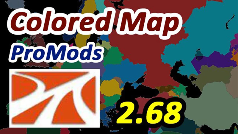
The overall image quality of the map has been improved.
Added color to the following regions: Northern Ireland, Isle of Man, Jersey, Svalbard and the Aland Islands.
Greenland has been added (partially displayed).
The coastlines and borders of the following countries and regions have been completely redrawn: Norway, Sweden (including the islands of Eland and Gotland according to the routes on ProMods and the Map of the Swedish Islands of Bengana), Finland, the Aland Islands, Belgium, the Netherlands, Luxembourg and Jersey.
The coasts and borders of the following countries and regions have been partially redrawn: Northern Ireland (“Restoration of Northern Ireland”), Great Britain, the Faroe Islands (SFIGC Map), Estonia and Russia (Gulf coast).
Credits:
Josecarpe
If the download link is outdated or doesn't work, you can add your download link. (If your link is valid, we will approve it within 24 hours.)
Download mod
| File | File size |
|---|---|
 Colored_Map_dlya_ProMods_2.68_Zoom_Crash_Fix
|
3 MB |