I will present my first map and project inspired by the Île-de-France region, located in France wich includes the city of Paris. The size of the map is approximately 1:1 but some parts may not look like the real thing and have been subject to changes. This is a standalone map.
[+] Addition of the city of Vincennes.
[+] Fixed many bugs.
[+] Map now compatible for people without the Krone DLC.
FUTURE UPDATES:
-Fixing all bugs.
-Improve old parts of the map.
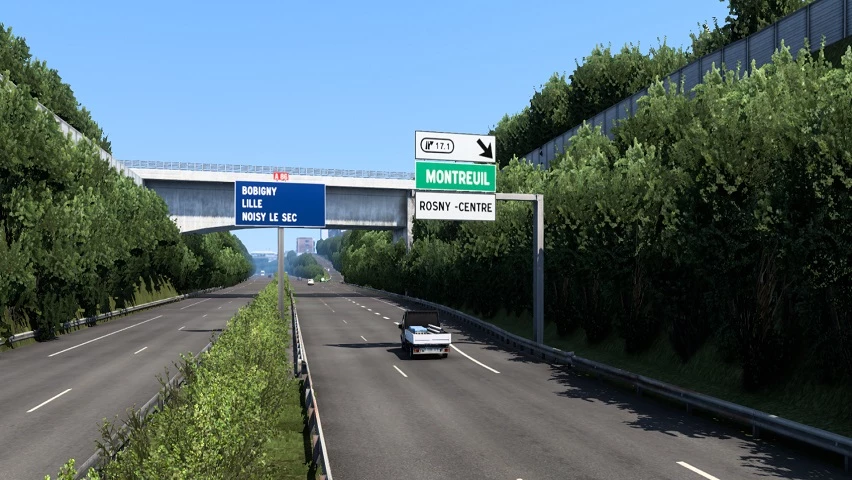
-Highways signs rework on the A3, A4 and A86.
-More cities.
-Add custom trailers matching with companies.
-Consistent deliveries with the production of the companies.
1.57 Compatibility
Changelog:
Changelog v0.1.4a
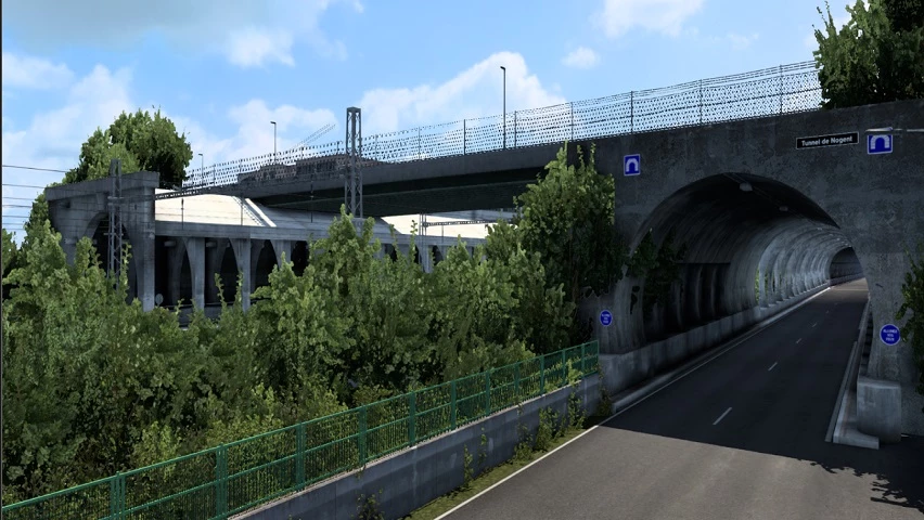
Bagnolet Rework:
Rebuilt Porte de Bagnolet interchange
Rebuilt Bel Est Shopping Center
Added a purchasable garage
2 new companies
Addition of a section of the Bois de Vincennes:
2 new companies
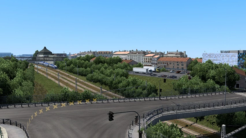
Addition of Rosny-sous-Bois City Center:
Added a purchasable garage
9 new companies
A3 Motorway Rework
Added several purchasable garages
Added skins for modded vehicles (skoda superb) (by Rayen and JenNezMare)
New license plates (by Adyox)
New road signs (by Adyox)
Other changes
Reduced mod file size
Bug fixes
Changelogs v0.1.3c
Improvement of delivery consistency
Addition of skin packs, sounds, and destination displays for modded vehicles (Skoda Superb, Bolloré Bluebus, Iveco Evadys & Solaris Urbino III)
Minor map modifications
Bug fixes
Changelog v0.1.3b
-Reconstruction of Charenton-le-Pont and Paris 20
-More Bugs fixes
Changelog v0.1.3
-Reconstruction of Charenton-le-Pont and Paris 20
-Bugs fixes
Changelog v0.1.2a
-Recreation of a section of the city of Vincennes
Bug fixes related to 1.51
Changelog v0.1.1b
-Bug fix addressing an issue that prevented the loading of cargo with certain trailers
Changelogs v0.1.1
Added the city of Champigny-sur-Marne including a deliverable company and a Volvo dealership
Added the city of Fontenay-sous-Bois including 2 deliverable companies and a bus station
Extension to the north of the city of Villemomble including a company and 2 deliverable worksites
Reconstruction of the Raincy-Villemomble RER bus station
Reconstruction of old parts of the A4 motorway
Reconstruction of the A4 – A86 interchange
Reconstruction of the A86 motorway from Champigny-sur-Marne to Fontenay-sous-Bois
New traffic signs (by Adyox) (5% of signs replaced)
Integration of more than 10 new AI vehicles (by Rayen)
Bug fix
Changelogs v0.1.0
-Addition of the City of Chessy including Disneyland Paris (2 delivery zones) and its emergency center (1 delivery zone)
-Reconstruction of the ring road of Paris and its interchanges, from Porte de Montreuil to Porte de Bercy
-Added a small section of the Town of Bussy-Saint-Georges (including 2 deliverable companies as well as a repair shop and a Mercedes-Benz dealership
-Added a new deliverable company in Rosny-sous-Bois (Lidl)
-Addition of metro stops in Paris
-Addition of 2 temporary truck purchasing zones (Scania & Volvo) while a dealer of these brands is added to the map
-Added custom trailer skins (by Rayen, Lumia and Yellow)
-Integration of new AI (by Rayen)
-Fixed the spawn of the correct tram trains depending on the line
-Changed the textures of the police pedestrians in the base game to represent the French National Police and the Gendarmerie (by Rayen)
-Added custom electronic destination sign for buses for lines available on the map. (Compatible with Solaris Urbino)
-Use “N” to use the bus gong horn sound (for bus mods)
-Adjusted the map economy
-Adjusted the traffic density of the map (Use the `g_traffic` command to adjust: `0.5` for the base traffic before this update, `1` for the recommended traffic, `3` for heavy traffic (maximum recommended))
-Fixed Krone and modded trailers not being able to take cargo
-Bugs fixes
Update: v0.09b
-Addition of a part of the city of Neuilly-Plaisance (including 2 company)
-Bug fixes
-With the 0.0.9b version, the West Balkans DLC is no longer mandatory to run the map
Changelogs v0.0.9a
-Addition of a part of the city of Neuilly-Plaisance (including 2 company)
-Bug fixes
Changes v0.0.8a
-Addition of the 4th arrondissement of Paris (including Place de la Bastille, the Bercy – Seine Bus Station and 5 companies)
-Addition of the city of Saint-Maurice (including 1 company)
-Entire recreation of the north of the city of Rosny-sous-Bois and the west of Villemomble (including the addition of the Westifield Rosny 2 Shopping Center)
-Recreation of the A4 motorway (between Créteil and Paris)
-Added bus lines icons to bus stops (visible at maximum map zoom)
-Bug fixes
LAST UPDATE : V0.0.7b for ETS 2 1.47 Beta
-Addition of the International Rungis Market (Market Home & Meat Products Sector)
-File size reduced
-Fixed some bugs
Changelog v0.0.6
The size of the mod is reduced
Fixed bugs
LAST UPDATE V0.0.5
[+] Addition of the city of Créteil, specifically the Échat district.
[+] Addition of Villemomble city center.
[+] Extension of the A4 to the town of Collégien.
[+] Addition of country roads.
[+] Added custom AI vehicles and decoration.
[+] Custom Parisian traffic lights.
[+] Added details in Paris.
[+] Addition of the English translation of certain GPS messages for other languages (department change message…).
[+] Fixed some bugs.
[+] More than 22 km of roads added.
[+] And much more !
Changelog v0.04
-Addition of the city of Vincennes.
-Fixed many bugs.
-Map now compatible for people without the Krone DLC.
Update 0.02:
[+] Fixed major bug : removed invisible walls on highways (in A86, A3).
[+] Added decorations, street lamps and missing bridges on A3.
Update 0.1:
[+] OFFICIAL RELEASE
[+] Cities of Rosny-sous-Bois, Charenton-le-Pont, Saint-Mandé, Vincennes, Bagnolet and the 12 and 20th districts of Paris.
[+] SNCF, Bercy 2, La Poste, Carrefour, Eiffage, SFCP, Westfield Rosny 2, Marché Grand Frais, Castorama and the Rosny-sous-Bois pedagogic farm companies.
[+] A3, A4, A86, A103 and A186 highways.
Credits:
Georges93
If the download link is outdated or doesn't work, you can add your download link. (If your link is valid, we will approve it within 24 hours.)
Download mod
| File | File size |
|---|---|
 idf_map_1.44.x
|
3 MB |
|
idf_map_v0.02_1.44.x
|
3 MB |
|
paris_suburbs_map_v0.03_1.45.x
|
61 MB |
|
paris_suburbs_map_v0.04_1.45.x
|
61 MB |
|
paris_suburbs_map_v0.0.5_1.46.x
|
174 MB |
 paris_suburbs_map_v0.0.6_1.46.x
|
98 MB |
|
paris_suburbs_map_v0.0.7_1.47.x
|
108 MB |
|
paris_suburbs_map_v0.0.8_1.48.x
|
94 MB |
|
paris_suburbs_map_v0.0.9b_1.49.x
|
80 MB |
|
paris_suburbs_map_v0.1.0_1.49.x
|
155 MB |
|
paris_suburbs_map_v0.1.1_1.50.x_UNZipMe
|
282 MB |
|
paris_suburbs_map_v0.1.2_1.51.x
|
1 GB |
|
paris_suburbs_map_v0.1.3c_1.53.x
|
322 MB |
|
paris_suburbs_map_v0.1.4a_1.54.x
|
356 MB |
|
paris_suburbs_map_v0.1.5a_1.56.x
|
576 MB |
|
paris_suburbs_map_v0.1.5c_1.57.x
|
593 MB |

attention bourrer de bugs
j ai téléchargé la map qui est super, le seul problème c est quand on veut accéder au menu avec la touche echap. on sort du jeux et quand on revient on a plus de mission, il y t il un correctif ?
c’est vrai